Brush strokes on roads
A road drawn with stroke is a crisp constant-width band — correct, and obviously
machine-made. A road drawn with line is a brush dragged along the geometry,
with pressure and speed varying over the stroke.
"glazing":       { "type": "brush", "src": "file:brushes/watercolor_glazing.myb" },
"glazing_brush": { "op": "brush-file", "src": "@glazing" },"roads_trunk_f": { "op": "features", "source": "basemap", "layer": "roads",                   "min-zoom-field": "min_zoom",                   "filter-expr": ["in", ["get", "kind_detail"],                                   ["literal", ["trunk", "primary", "motorway"]]] },"roads_trunk": {  "op": "line", "features": "@roads_trunk_f", "brush": "@glazing_brush",  "color": "$road", "radius-px": 1.6, "opacity": 0.6,  "pressure-base": 0.7, "pressure-jitter": 0.2, "dtime": 0.05,  "radius-stroke-curve":  [[0.0, -1.4], [0.12, 0.0], [0.88, 0.0], [1.0, -1.8]],  "opacity-stroke-curve": [[0.0, -0.25], [0.1, 0.0], [0.9, 0.0], [1.0, -0.35]],  "dtime-stroke-curve":   [[0.0, 2.5],  [0.15, 1.0], [0.85, 1.0], [1.0, 3.0]]}
From
watercolor.json.
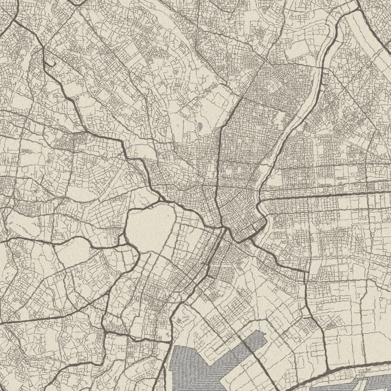
pencil-sketch.json: ten stroke layers, one sketchy-line function, wobble and all.Brushes come from you
Section titled “Brushes come from you”Nothing is bundled. Declare any MyPaint .myb brush as a source and load it with
brush-file. The example styles ship CC0 brushes by David Revoy next to their
style JSON; file: paths resolve against --assets-dir, so render those from a
checkout. For a portable style, use an http(s):// or data: source instead —
see sources.
brush-solid synthesizes a brush when you want the stroke machinery without an
asset.
Stroke curves are the whole trick
Section titled “Stroke curves are the whole trick”A *-stroke-curve is a list of [t, delta] control points where t runs 0→1
along the stroke. The shape above says: start thin, hold, taper at the end.
That is what makes a stroke look like it was begun and ended rather than extruded. Three curves are worth setting:
radius-stroke-curve— negative deltas at both ends give tapered entry and exit. Asymmetric values (−1.4 in, −1.8 out) read as a hand lifting.opacity-stroke-curve— fading the ends slightly keeps intersections from building into dark knots where many roads meet.dtime-stroke-curve— speed. Fast at the ends, slow through the middle, which changes how much paint the brush lays down.
Stroke curves are arrays, so a plain $param cannot reach into them — but a
function argument substitutes structurally and can. That is how one stroke
recipe serves many layers; see functions.
Wobble: wave before line
Section titled “Wobble: wave before line”Pressure variation alone still follows the survey line exactly. Perturb the geometry first:
"wob": { "op": "wave", "features": "@roads_f", "amplitude-px": 0.8 },"draw": { "op": "line", "features": "@wob", "brush": "@pencil", "color": "$ink", "radius-px": 1.2 }Sub-pixel amplitude is enough — 0.8 px reads as a hand not quite following a
ruler, while 3 px reads as bad data. wave is a Features → Features transform,
so it composes with any downstream paint op.
Factor it into a function
Section titled “Factor it into a function”Ten road classes differing only in layer, colour, and width should be one
declaration called ten times. This is exactly what
pencil-sketch.json
does with its sketchy-line function:
"functions": { "sketchy-line": { "inputs": { "features": { "kind": "features" }, "brush": { "kind": "brush" }, "color": { "kind": "scalar" }, "radius": { "kind": "scalar", "default": 1.0 } }, "output": "@draw", "output-kind": "raster", "nodes": { "wob": { "op": "wave", "features": "@features", "amplitude-px": 0.8 }, "draw": { "op": "line", "features": "@wob", "brush": "@brush", "color": "@color", "radius-px": "@radius" } } }}Calls with identical arguments share cache entries, so inlining costs nothing.
Brush strokes are the most expensive thing in a painterly style — every dab along
every line is real work. Two levers: gate minor classes behind min-zoom on the
features node so they only appear where they matter, and use stroke rather
than line for hairline classes where the brush texture would not be visible
anyway.
Map renders on this site are made fromOpenStreetMap data viaProtomaps (© OpenStreetMap contributors), elevation from Re:Earth Terrain,Mapterhorn andEGM2008 (NGA), and aerial imagery from GSI Japan(© 国土地理院). The painterly styles use CC0 brushes byDavid Revoy.